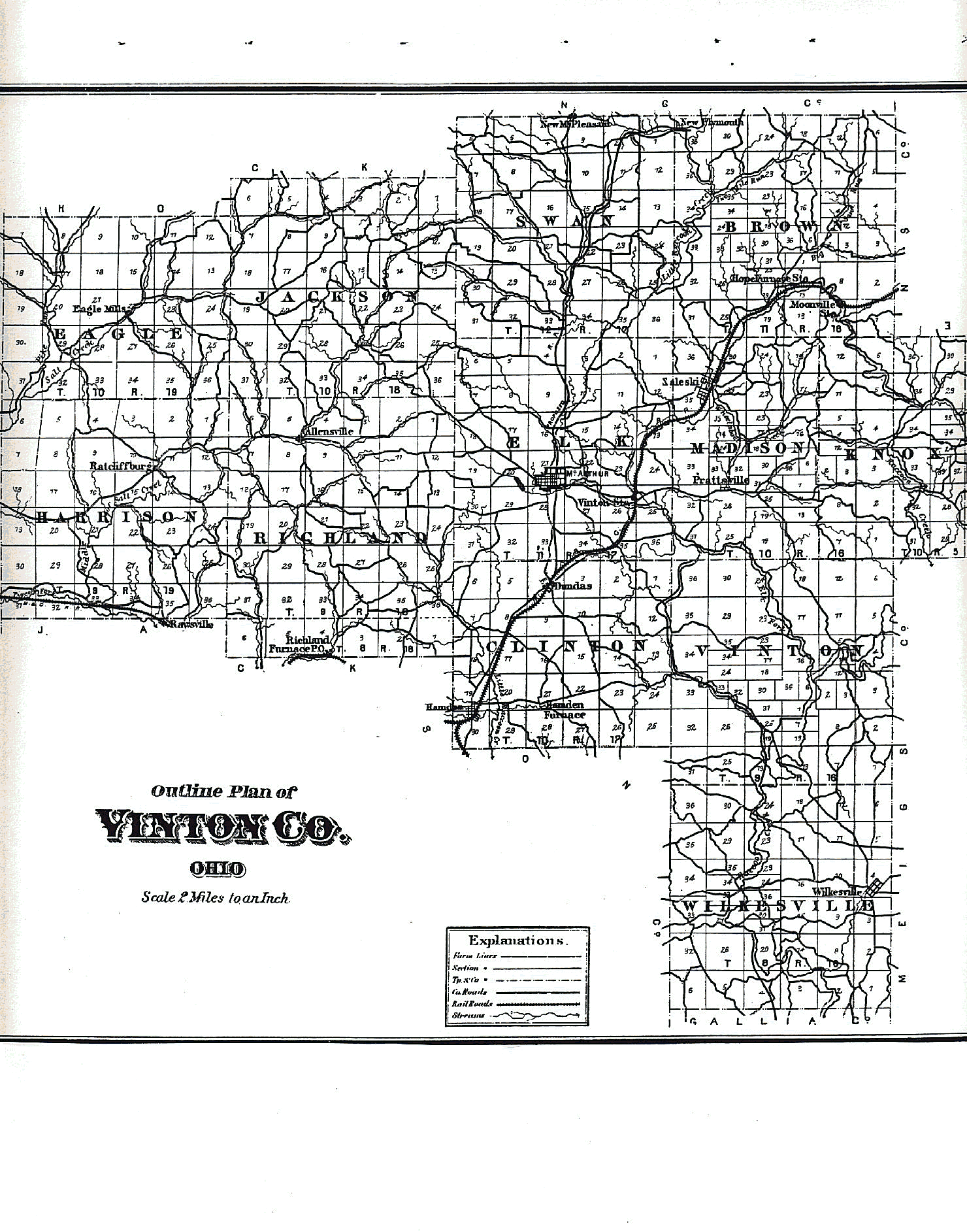
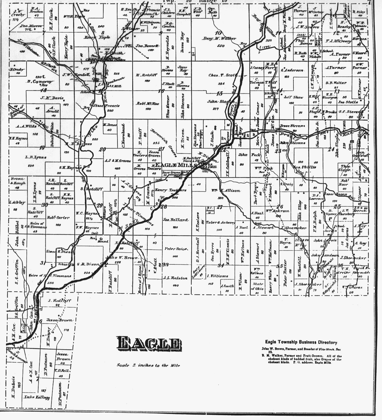
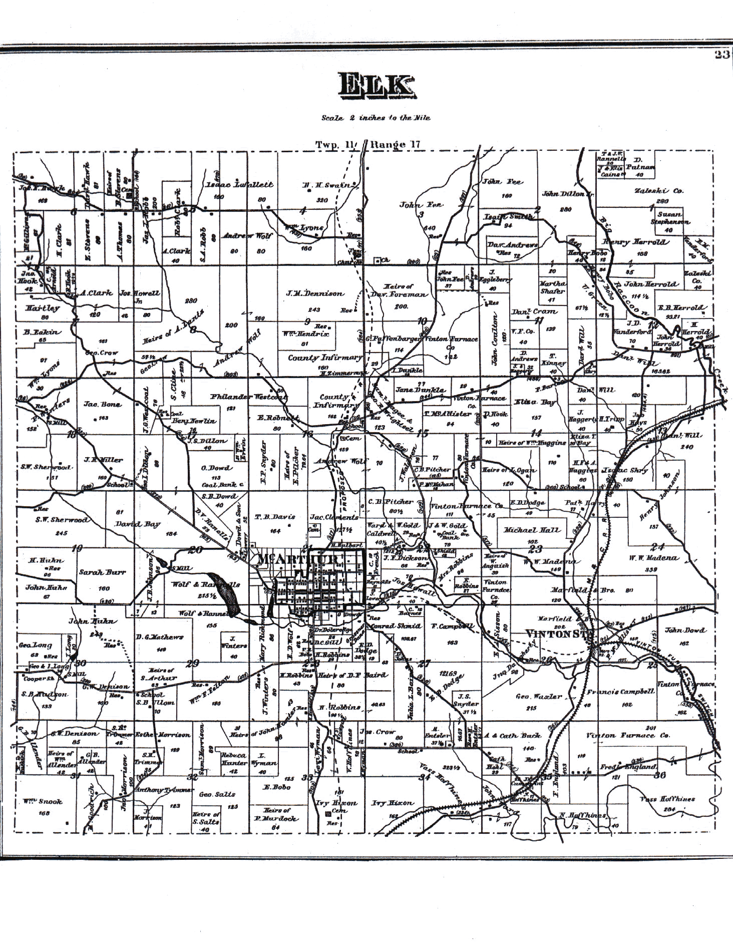
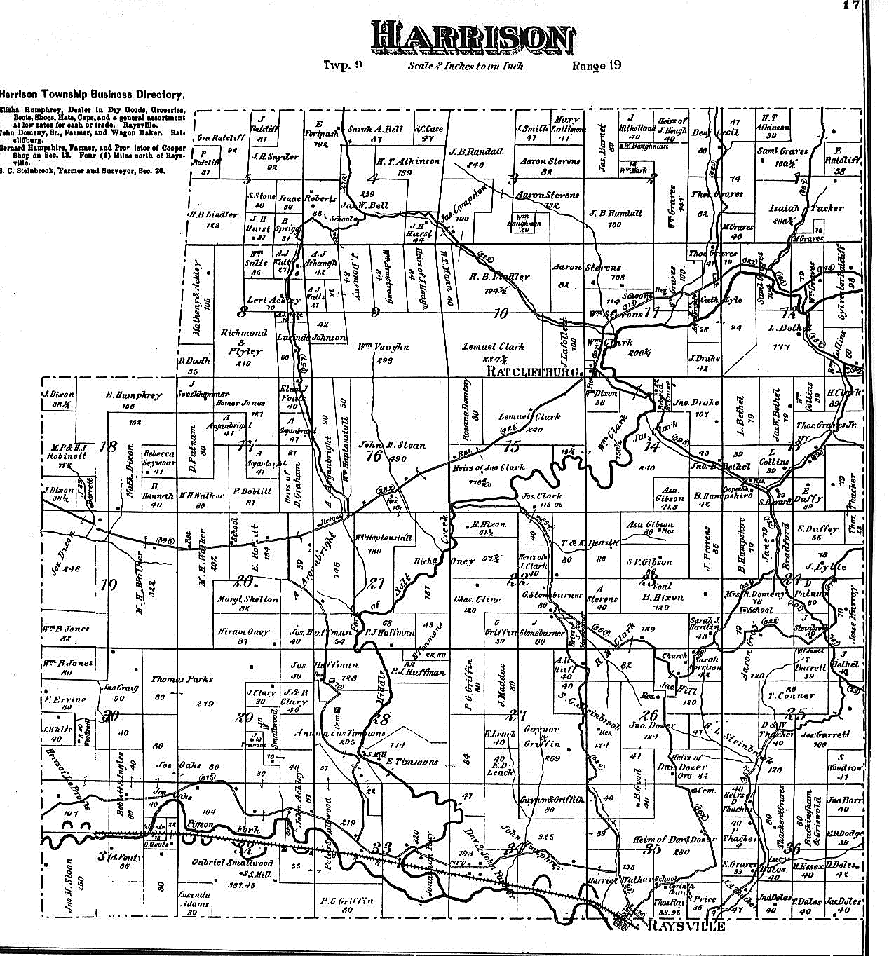
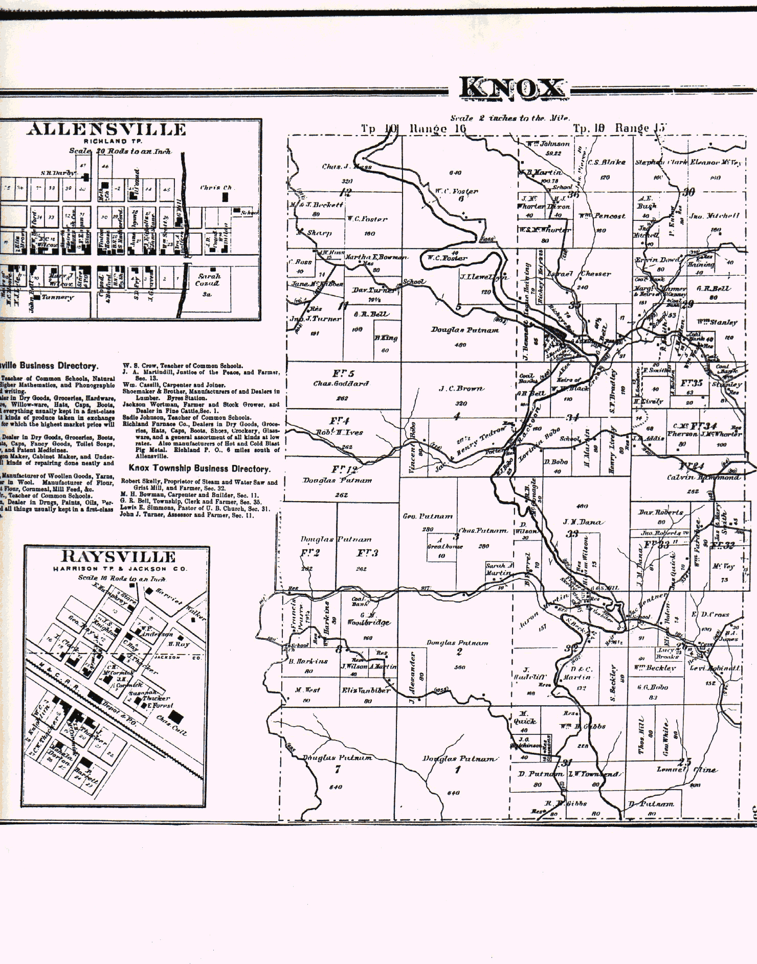
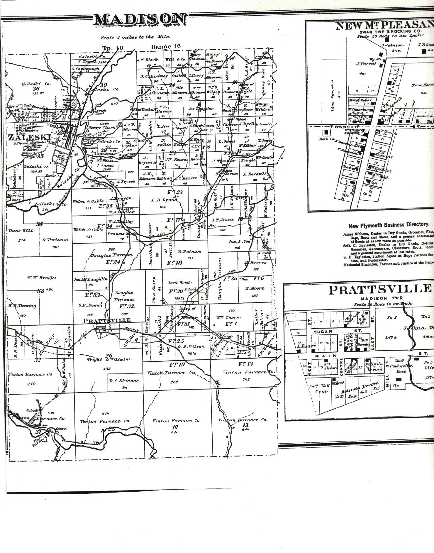
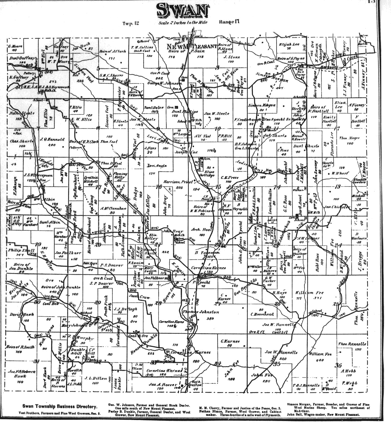
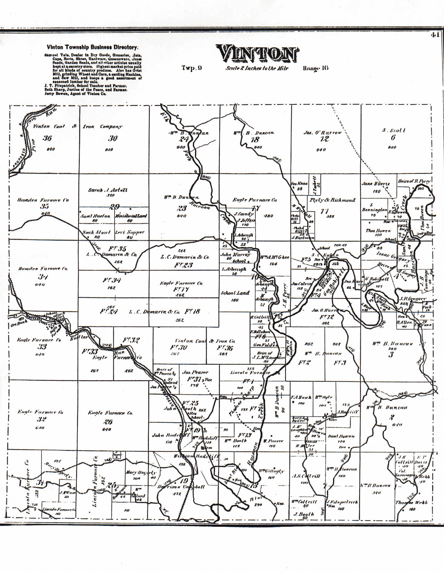
If you know the legal description of the land, you can determine where the person lived. By observing the location of nearby towns, roads and streams, you may relate it to what is there now.
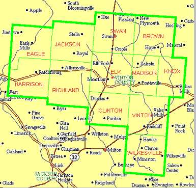
Click on the name of the township below to load the township's image.
Since these are large files and will take a while to load, I suggest that after you have the image, you right-click on the image and save it to your hard disk. Then you can look at the images all you want with your web browser or other image viewing software without having to reload it from the internet.
1875 Map of Vinton County (382 KB)
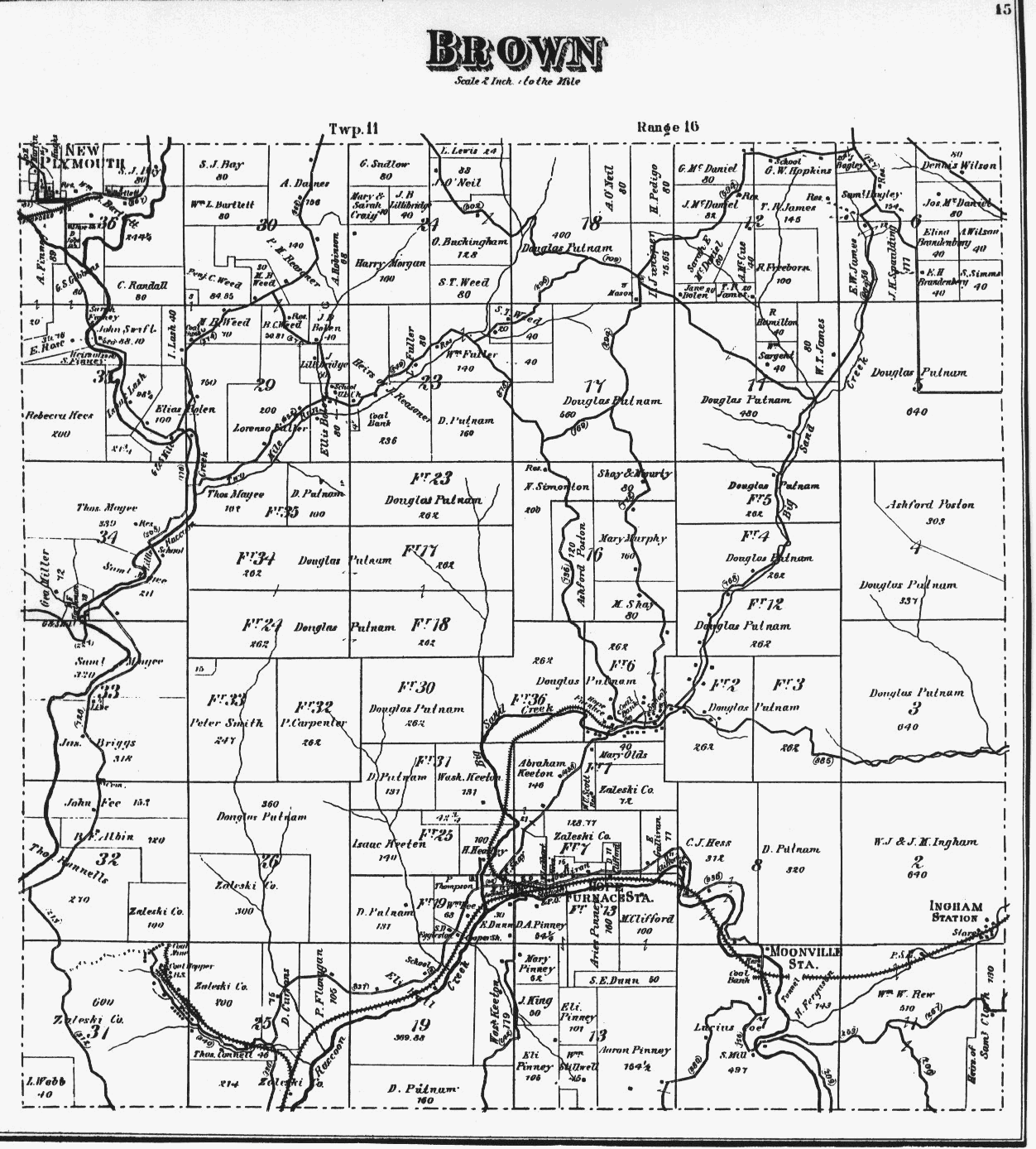
Brown Twp. (263 KB)
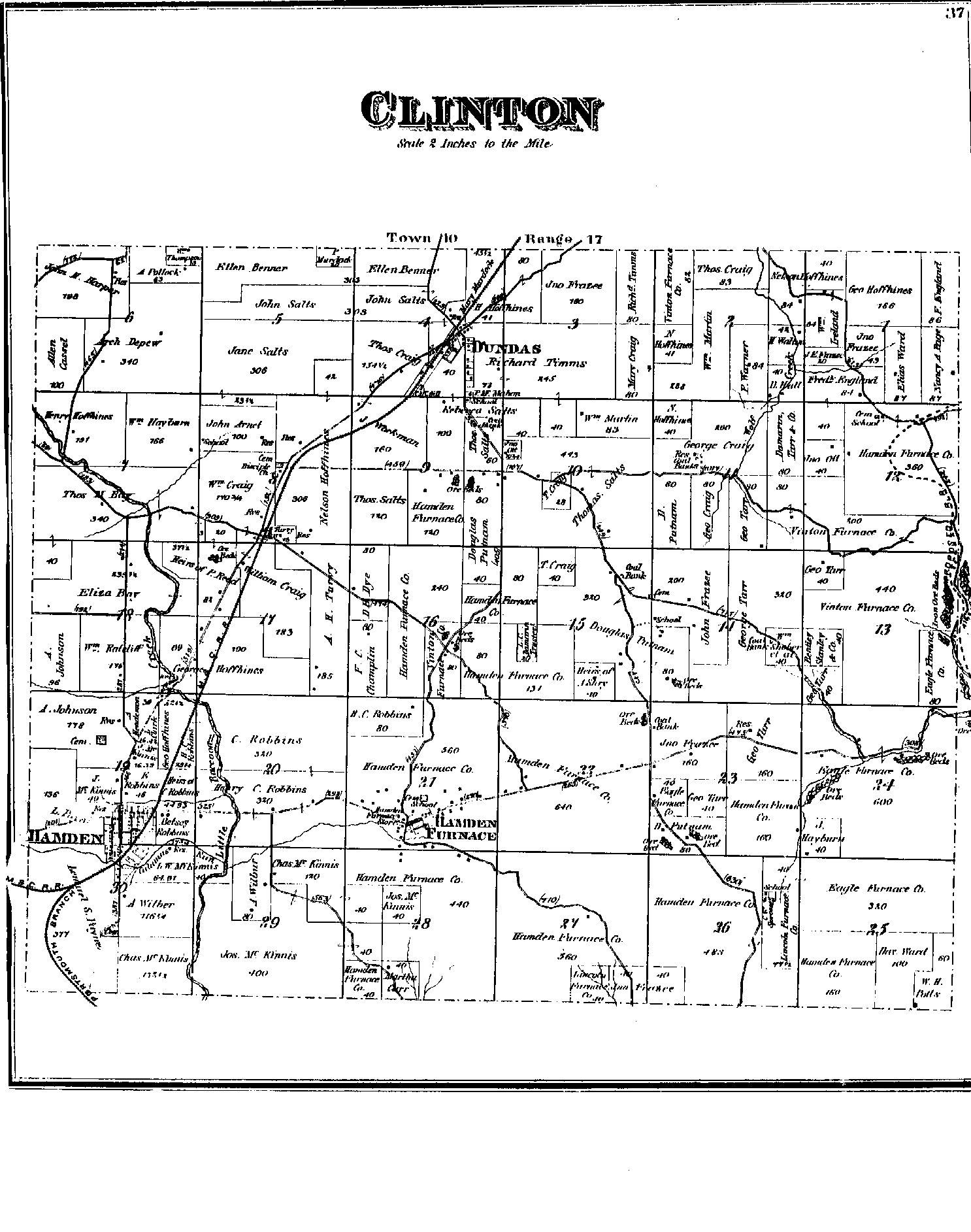
Clinton Twp. (91 KB)
Eagle Twp. (311 KB)
Elk Twp. (458 KB)
Harrison Twp. (241 KB)
Jackson Twp. (363 KB)
Knox Twp. (438 KB)
Madison Twp. (438 KB)
Richland Twp. (387 KB)
Swan Twp. (346 KB)
Vinton Twp. (878 KB)
Wilkesville Twp. (490 KB)
Last updated: